Hunter Trail, Picacho Peak State Park, AZ
On February 11, 2025 Kim and I hiked the Hunter Trail to Picacho Peak in Picacho Peak State Park. The trail is fairly steep, but with many switchbacks, up to a “saddle” with a beautiful view. The trail then descends very steeply before climbing up the “back side” of the mountain to Picacho Peak. Several spots on this part of the trail were very steep, on smooth rock, or on the “edge” such that you needed to use the (very handy) cables for climbing. This was quite an adventure but well worth it for the 360o views at the peak.
Walk-Specific Map
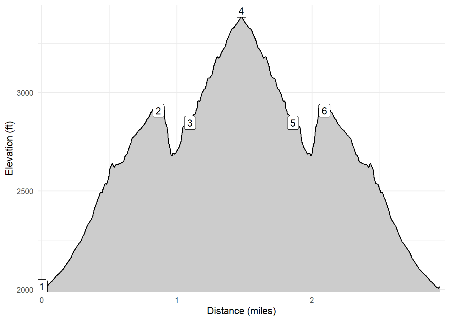
Elevation Profile
Images

PCHOPK01: Sign at start of trail

PCHOPK01: Initial view up to the peak

PCHOPK01: Kim climbing to the saddle

PCHOPK01: Typical scenery Winter 2025

PCHOPK01: Kim climbing to the saddle

PCHOPK03: Kim and I at the peak

PCHOPK03: View from the peak

PCHOPK03: Climbing down

PCHOPK03: Climbing down with aid of cables

PCHOPK03: Climbing down with aid of cables

PCHOPK03: Climbing down with aid of cables

PCHOPK03: Climbing down with aid of cables

PCHOPK03: Typical scenery Winter 2025

PCHOPK03: Climbing down with aid of cables
GPX Download
A sanitized GPX file of our hike is here.
Summary Information
| NUM | trackID | Primary | Description | Distance | CumDist | DeltaElev |
|---|---|---|---|---|---|---|
| 1 | PCHOPK01 | Hunter Tr | Barrett Loop parking lot to saddle | 0.86 | 0.86 | 893 |
| 2 | PCHOPK02 | Hunter Tr | saddle to Sunset View Tr | 0.23 | 1.10 | -63 |
| 3 | PCHOPK03 | Hunter Tr | Sunset View Tr to Picacho Peak | 0.38 | 1.48 | 570 |
| 4 | PCHOPK03 | Hunter Tr | Picacho Peak to Sunset View Tr | 0.38 | 1.86 | -570 |
| 5 | PCHOPK02 | Hunter Tr | Sunset View Tr to saddle | 0.23 | 2.09 | 63 |
| 6 | PCHOPK01 | Hunter Tr | saddle to Barrett Loop parking lot | 0.86 | 2.96 | -893 |