Fish Farm Mounds State Preserve
User-Defined Loop I
Cash and I explored Fish Farm Mounds State Preserve and adjoining Fish Farm Mounds Wildlife Management Area on November 26, 2024. It is always humbling and inspiring to be near the burial sites of Indigenous peoples, thought the story (here and here) of how the mounds have been “researched” (i.e., pillaged) is, while predictable, still disheartening. The trails behind the mound complex area were well maintained (i.e., cleared) and interesting as they traversed through mature hardwoods, rocky outcrops, and deep ravines.
Walk-Specific Map
Take Note
- Click on a segment to get specific information.
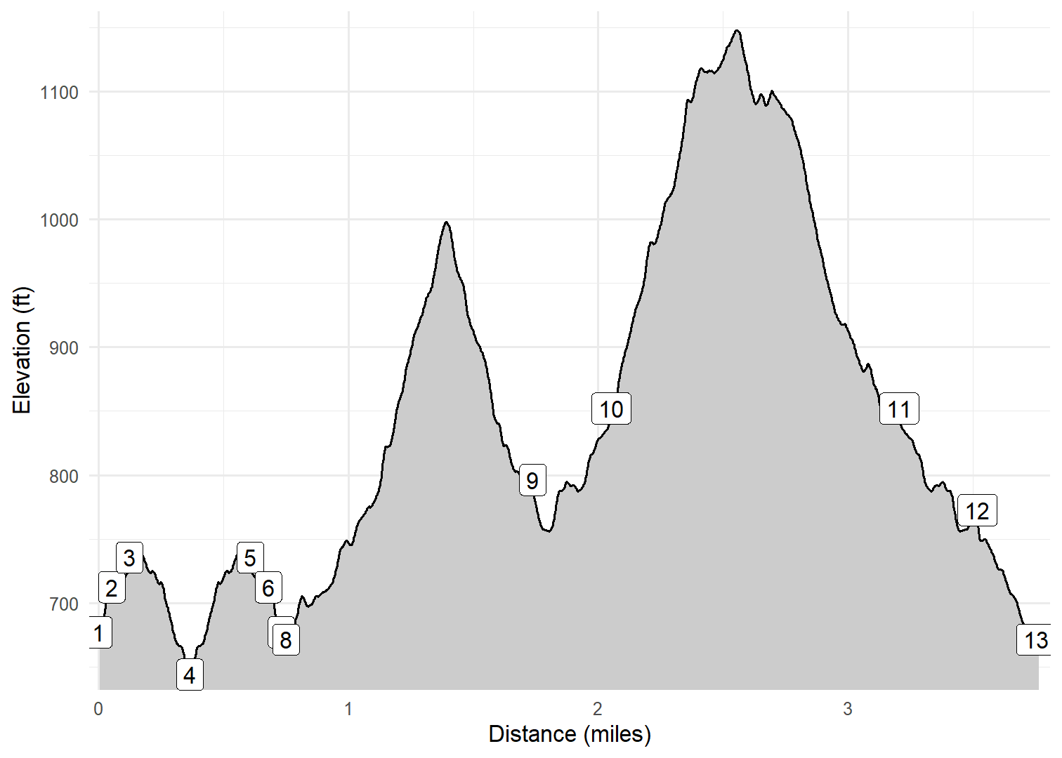
- Numeric labels correspond to the same labels in the elevation profile and summary information below.
Elevation Profile

Images
GPX Download
A sanitized GPX file of our hike is here.
Summary Information
| NUM | trackID | Primary | Description | Type | Owner | Distance | CumDist | DeltaElev |
|---|---|---|---|---|---|---|---|---|
| 1 | FFMDS01 | Fish Farm Mounds SP | Picnic area to Mounds (start) | Trail | Public | 0.05 | 0.05 | 35 |
| 2 | FFMDS02 | Fish Farm Mounds SP | Mounds (start) to Mounds (end) | Trail | Public | 0.07 | 0.12 | 23 |
| 3 | FFMDS03 | Fish Farm Mounds SP | Mounds (end) to Hwy 26 | Trail | Public | 0.24 | 0.37 | -92 |
| 4 | FFMDS03 | Fish Farm Mounds SP | Hwy 26 to Mounds (end) | Trail | Public | 0.24 | 0.61 | 92 |
| 5 | FFMDS02 | Fish Farm Mounds SP | Mounds (end) to Mounds (start) | Trail | Public | 0.07 | 0.68 | -23 |
| 6 | FFMDS01 | Fish Farm Mounds SP | Mounds (start) to Picnic area | Trail | Public | 0.05 | 0.73 | -35 |
| 7 | FFMDS05 | Fish Farm Mounds SP | to | Trail | Public | 0.02 | 0.75 | -6 |
| 8 | FFMDS06 | Fish Farm Mounds SP | to | Trail | Public | 0.99 | 1.74 | 125 |
| 9 | FFMDS10 | Fish Farm Mounds SP | to | Trail | Public | 0.31 | 2.05 | 56 |
| 10 | FFMDS11 | Fish Farm Mounds SP | to | Trail | Public | 1.15 | 3.20 | 2 |
| 11 | FFMDS10 | Fish Farm Mounds SP | to | Trail | Public | 0.31 | 3.52 | -56 |
| 12 | FFMDS07 | Fish Farm Mounds SP | to | Trail | Public | 0.23 | 3.75 | -95 |
| 13 | FFMDS05 | Fish Farm Mounds SP | to | Trail | Public | 0.02 | 3.77 | 6 |

