Brush Creek Canyon State Preserve
User-Defined Loop
Cash and I walked the road into and the trail that starts at the parking area of Brush Creek Canyon State Preserve. The trail eventually disappears but I made a loop below the bluffs to where two streams come together before eventually ending on top of the bluffs for a hike back to the parking area. This was a very beautiful hike through a mature hardwood forest with a main stream and several feeder streams as well as a number of impressive limestone bluffs. The view from the “overlook” was very nice.
Walk-Specific Map
Take Note
- Click on a segment to get specific information.
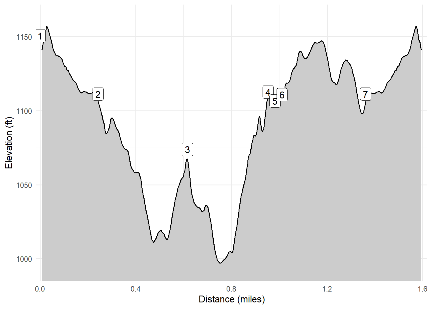
- Numeric labels correspond to the same labels in the elevation profile and summary information below.
Elevation Profile
Images

BRCC02: Restrooms

BRCC02: Actual trail at start

BRCC02: Pavillion

BRCC02: Limestone bluffs

BRCC03: At streams confluence

BRCC03: Looking upstream on Brush Creek

BRCC03: Limestone bluffs

BRCC04: Crack in bluffs to get to top
GPX Download
A sanitized GPX file of our hike is here.
Summary Information
| NUM | trackID | Primary | Description | Type | Owner | Distance | CumDist | DeltaElev |
|---|---|---|---|---|---|---|---|---|
| 1 | BRCC01 | Brush Creek Canyon SP | Park Entrance to Parking area | Gravel | Public | 0.24 | 0.24 | -39 |
| 2 | BRCC02 | Brush Creek Canyon SP | Parking area to Start of deer trail | Trail | Public | 0.37 | 0.62 | -35 |
| 3 | BRCC03 | Brush Creek Canyon SP | Start of deer trail to Trail to overlook | Trail | Public | 0.34 | 0.95 | 39 |
| 4 | BRCC04 | Brush Creek Canyon SP | Trail to overlook to Overlook | Trail | Public | 0.03 | 0.98 | -6 |
| 5 | BRCC04 | Brush Creek Canyon SP | Overlook to Trail to overlook | Trail | Public | 0.03 | 1.01 | 6 |
| 6 | BRCC05 | Brush Creek Canyon SP | Trail to overlook to Parking area | Trail | Public | 0.35 | 1.36 | -5 |
| 7 | BRCC01 | Brush Creek Canyon SP | Parking area to Park Entrance | Gravel | Public | 0.24 | 1.60 | 39 |